 vesseltracker.com
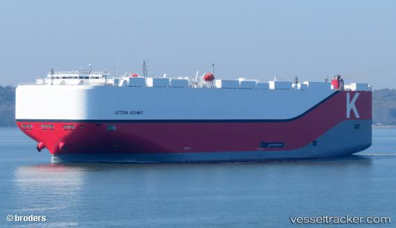
Vessel Victoria Highway IMO: 9827255, MMSI: 374069000 Vehicles Carrier
UTC, -24.23187, -46.49935, course: 241, speed: 0.3
UTC, -24.22404, -46.50127, course: 218, speed: 0.3
2026-02-18 23:36:18 UTC, -24.22280, -46.50373, course: 203, speed: 0.1
Live AIS position:
UTC. 18 nm S of São Vicente),
updated 2026-02-18 23:36:18 UTC.
Find the position of the vessel Victoria Highway on the map. The latter are known coordinates and path.
marine traffic ship tracker show on live map
The current position of vessel Victoria Highway is -24.22280 lat / -46.50373 lng. Updated: 2026-02-18 23:36:18 UTCCurrently sailing under the flag of Panama
Details:
Last coordinates of the vessel:
UTC, -24.22026, -46.48475, course: 79, speed: 3.1UTC, -24.23187, -46.49935, course: 241, speed: 0.3
UTC, -24.22404, -46.50127, course: 218, speed: 0.3
2026-02-18 23:36:18 UTC, -24.22280, -46.50373, course: 203, speed: 0.1