 vesseltracker.com
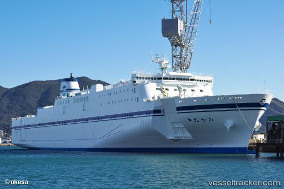
Vessel Kitakami IMO: 9831749, MMSI: 431012359 Passenger Ro Ro Cargo Ship
UTC, 42.63716, 141.63486, course: 243, speed: 0
UTC, 42.63716, 141.63483, course: 243, speed: 0
2026-02-16 05:42:05 UTC, 42.63715, 141.63483, course: 243, speed: 0.1
Live AIS position:
UTC. Near Tomakomai),
updated 2026-02-16 05:42:05 UTC.
Find the position of the vessel Kitakami on the map. The latter are known coordinates and path.
marine traffic ship tracker show on live map
The current position of vessel Kitakami is 42.63715 lat / 141.63483 lng. Updated: 2026-02-16 05:42:05 UTCDetails:
Last coordinates of the vessel:
UTC, 42.31790, 141.59700, course: 355, speed: 18.5UTC, 42.63716, 141.63486, course: 243, speed: 0
UTC, 42.63716, 141.63483, course: 243, speed: 0
2026-02-16 05:42:05 UTC, 42.63715, 141.63483, course: 243, speed: 0.1