 vesseltracker.com
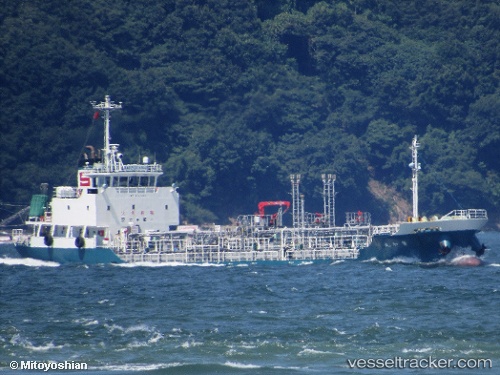
Vessel Towa Maru IMO: 9832092, MMSI: 431010068 Chemical Tanker
UTC, 34.77421, 139.28065, course: 46, speed: 11.6
UTC, 34.89304, 139.45230, course: 51, speed: 11.1
2026-01-18 18:59:50 UTC, 34.89435, 139.45425, course: 51, speed: 11.1
Live AIS position:
UTC. 10 nm N of Nishitokyo),
updated 2026-01-18 18:59:50 UTC.
Find the position of the vessel Towa Maru on the map. The latter are known coordinates and path.
marine traffic ship tracker show on live map
The current position of vessel Towa Maru is 34.89435 lat / 139.45425 lng. Updated: 2026-01-18 18:59:50 UTCCurrently sailing under the flag of Japan
Details:
Last coordinates of the vessel:
UTC, 34.77227, 139.27831, course: 46, speed: 11.6UTC, 34.77421, 139.28065, course: 46, speed: 11.6
UTC, 34.89304, 139.45230, course: 51, speed: 11.1
2026-01-18 18:59:50 UTC, 34.89435, 139.45425, course: 51, speed: 11.1