 vesseltracker.com
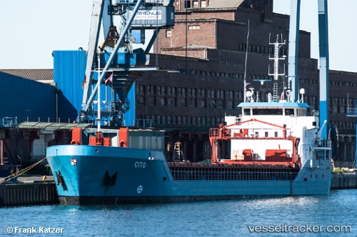
Vessel FAST SIM IMO: 9356517, MMSI: 205011000 General Cargo Ship
UTC, 51.25368, 4.35446, course: 238, speed: 0
UTC, 51.25370, 4.35445, course: 238, speed: 0
2026-03-25 01:27:46 UTC, 51.25369, 4.35446, course: 238, speed: 0
Live Vessel FAST SIM Analytics (details, animations, etc.)
Live AIS position: UTC. Near Pijp Tabak), updated 2026-03-25 01:27:46 UTC.Find the position of the vessel FAST SIM on the map. The latter are known coordinates and path.
marine traffic ship tracker show on live map
The current position of vessel FAST SIM is 51.25369 lat / 4.35446 lng. Updated: 2026-03-25 01:27:46 UTCCurrently sailing under the flag of Belgium
FAST SIM built in 2008 year
Deadweight:
3609 tDetails:
Last coordinates of the vessel:
UTC, 51.25370, 4.35447, course: 238, speed: 0UTC, 51.25368, 4.35446, course: 238, speed: 0
UTC, 51.25370, 4.35445, course: 238, speed: 0
2026-03-25 01:27:46 UTC, 51.25369, 4.35446, course: 238, speed: 0