 vesseltracker.com
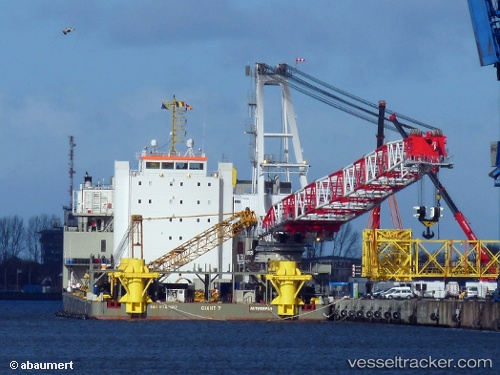
Vessel Giant 7 IMO: 9760017, MMSI: 205687000 Heavy Load Carrier
UTC, 51.88685, 4.45168, course: -1, speed: 0
UTC, 51.88679, 4.45173, course: -1, speed: 0.1
2026-03-12 21:55:15 UTC, 51.88680, 4.45163, course: -1, speed: 0
Live Vessel Giant 7 Analytics (details, animations, etc.)
Live AIS position: UTC. Near Rotterdam), updated 2026-03-12 21:55:15 UTC.Find the position of the vessel Giant 7 on the map. The latter are known coordinates and path.
marine traffic ship tracker show on live map
The current position of vessel Giant 7 is 51.88680 lat / 4.45163 lng. Updated: 2026-03-12 21:55:15 UTCCurrently sailing under the flag of Belgium
Details:
Last coordinates of the vessel:
UTC, 51.88673, 4.45162, course: -1, speed: 0.1UTC, 51.88685, 4.45168, course: -1, speed: 0
UTC, 51.88679, 4.45173, course: -1, speed: 0.1
2026-03-12 21:55:15 UTC, 51.88680, 4.45163, course: -1, speed: 0