 vesseltracker.com
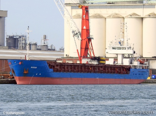
Vessel Marie IMO: 9252929, MMSI: 205724000 General Cargo Ship
UTC, 51.80275, 4.64277, course: 210, speed: 0
UTC, 51.80270, 4.64277, course: 207, speed: 0
2026-03-10 20:10:41 UTC, 51.80275, 4.64282, course: 210, speed: 0
Live Vessel Marie Analytics (details, animations, etc.)
Live AIS position: UTC. Near Dordrecht), updated 2026-03-10 20:10:41 UTC.Find the position of the vessel Marie on the map. The latter are known coordinates and path.
marine traffic ship tracker show on live map
The current position of vessel Marie is 51.80275 lat / 4.64282 lng. Updated: 2026-03-10 20:10:41 UTCCurrently sailing under the flag of Belgium
Marie built in 2002 year
Deadweight:
2974 tDetails:
Last coordinates of the vessel:
UTC, 51.80275, 4.64280, course: -1, speed: 0UTC, 51.80275, 4.64277, course: 210, speed: 0
UTC, 51.80270, 4.64277, course: 207, speed: 0
2026-03-10 20:10:41 UTC, 51.80275, 4.64282, course: 210, speed: 0