 vesseltracker.com
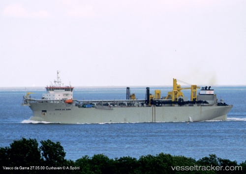
Vessel Vasco Da Gama IMO: 9187473, MMSI: 205744000 Hopper Dredger
UTC, 1.22016, 103.62981, course: 278, speed: 0.2
UTC, 1.22006, 103.63040, course: 121, speed: 0.4
2026-01-19 18:13:24 UTC, 1.22223, 103.68644, course: 67, speed: 11.8
Live AIS position:
UTC. Near JURONG ISLAND),
updated 2026-01-19 18:13:24 UTC.
Find the position of the vessel Vasco Da Gama on the map. The latter are known coordinates and path.
marine traffic ship tracker show on live map
The current position of vessel Vasco Da Gama is 1.22223 lat / 103.68644 lng. Updated: 2026-01-19 18:13:24 UTCCurrently sailing under the flag of Belgium
Vasco Da Gama built in 2000 year
Deadweight:
59235 tDetails:
Last coordinates of the vessel:
UTC, 1.21987, 103.63194, course: 266, speed: 0.1UTC, 1.22016, 103.62981, course: 278, speed: 0.2
UTC, 1.22006, 103.63040, course: 121, speed: 0.4
2026-01-19 18:13:24 UTC, 1.22223, 103.68644, course: 67, speed: 11.8