 vesseltracker.com
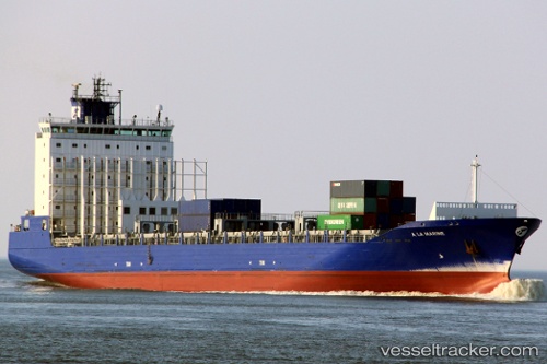
Vessel A LA MARINE IMO: 9386524, MMSI: 205795000 Container Ship
UTC, 41.31491, 2.20976, course: 62, speed: 0.2
UTC, 41.31489, 2.20986, course: 56, speed: 0.1
2026-03-08 07:36:00 UTC, 41.31462, 2.21035, course: 47, speed: 0.1
Live Vessel A LA MARINE Analytics (details, animations, etc.)
Live AIS position: UTC. Near Barcelona), updated 2026-03-08 07:36:00 UTC.Find the position of the vessel A LA MARINE on the map. The latter are known coordinates and path.
marine traffic ship tracker show on live map
The current position of vessel A LA MARINE is 41.31462 lat / 2.21035 lng. Updated: 2026-03-08 07:36:00 UTCCurrently sailing under the flag of Belgium
A LA MARINE built in 2009 year
Deadweight:
20069 tDetails:
Last coordinates of the vessel:
UTC, 41.31440, 2.21095, course: 29, speed: 0.1UTC, 41.31491, 2.20976, course: 62, speed: 0.2
UTC, 41.31489, 2.20986, course: 56, speed: 0.1
2026-03-08 07:36:00 UTC, 41.31462, 2.21035, course: 47, speed: 0.1