 vesseltracker.com
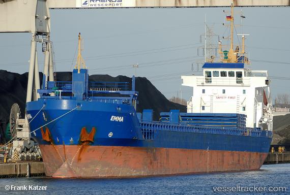
 Emma
Emma
Current Status
Where is the vessel?
Emma is currently in Near Passage West, based on AIS data received about 1h ago.
Latest AIS update:
Current position: 51.86867° N, 8.33224° W (Near Passage West)
Average speed (last 7 days): Loading…
Average speed (last 30 days): Loading…
Vessel profile: Emma is a Multi Purpose Carrier with dimensions 104m x 14m.
This page combines live AIS, route history, probable destination signals, nearby traffic, and port activity for practical vessel monitoring.
The current position of vessel Emma is 51.86867 lat / -8.33224 lng. Updated: 2026-03-26 01:58:54 UTCNearest reference points:
- Near Cobn
- Near Covent Garden
- Near HELVICK
Currently sailing under the flag of Cyprus ![]()
Emma built in 2004 year
Deadweight:
5745 tDetails:
Live Vessel Emma Analytics (details, animations, etc.)
Recent AIS points (UTC):
2026-03-25 20:16:49 UTC · 51.86866, -8.33229 · SOG 0 kn · COG 149°2026-03-25 21:22:47 UTC · 51.86873, -8.33217 · SOG 0 kn · COG 149°
2026-03-26 00:10:51 UTC · 51.86866, -8.33226 · SOG 0 kn · COG 149°
2026-03-26 01:58:54 UTC · 51.86867, -8.33224 · SOG 0 kn · COG 149°