 vesseltracker.com
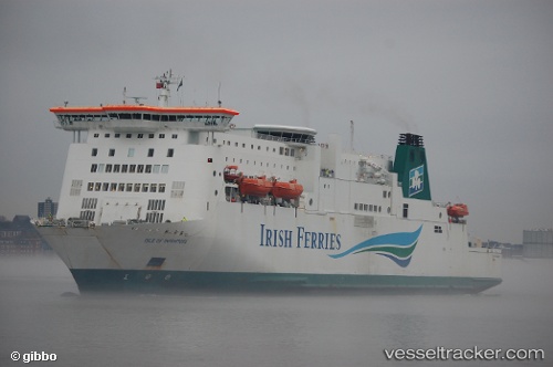
Vessel Isle Of Inishmore IMO: 9142605, MMSI: 209093000 Passenger Ro Ro Cargo Ship
UTC, 50.96807, 1.85186, course: 113, speed: 2.4
UTC, 51.07413, 1.51749, course: 337, speed: 17
2026-03-03 21:21:36 UTC, 51.06003, 1.47704, course: 119, speed: 18
Live AIS position:
UTC. Near Dover),
updated 2026-03-03 21:21:36 UTC.
Find the position of the vessel Isle Of Inishmore on the map. The latter are known coordinates and path.
marine traffic ship tracker show on live map
The current position of vessel Isle Of Inishmore is 51.06003 lat / 1.47704 lng. Updated: 2026-03-03 21:21:36 UTCCurrently sailing under the flag of Cyprus
Isle Of Inishmore built in 1997 year
Deadweight:
5860 tDetails:
Last coordinates of the vessel:
UTC, 51.12465, 1.33672, course: 158, speed: 0UTC, 50.96807, 1.85186, course: 113, speed: 2.4
UTC, 51.07413, 1.51749, course: 337, speed: 17
2026-03-03 21:21:36 UTC, 51.06003, 1.47704, course: 119, speed: 18