 vesseltracker.com
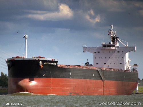
Vessel Captain Antonis IMO: 9583201, MMSI: 209270000 Bulk Carrier
UTC, -25.50168, -48.52618, course: 95, speed: 0
UTC, -25.50165, -48.52626, course: 95, speed: 0
2026-03-24 06:22:28 UTC, -25.50164, -48.52620, course: 95, speed: 0
Live Vessel Captain Antonis Analytics (details, animations, etc.)
Live AIS position: UTC. Near Paranagua), updated 2026-03-24 06:22:28 UTC.Find the position of the vessel Captain Antonis on the map. The latter are known coordinates and path.
marine traffic ship tracker show on live map
The current position of vessel Captain Antonis is -25.50164 lat / -48.52620 lng. Updated: 2026-03-24 06:22:28 UTCCurrently sailing under the flag of Cyprus
Captain Antonis built in 2011 year
Deadweight:
82177 tDetails:
Last coordinates of the vessel:
UTC, -25.50175, -48.52621, course: 95, speed: 0UTC, -25.50168, -48.52618, course: 95, speed: 0
UTC, -25.50165, -48.52626, course: 95, speed: 0
2026-03-24 06:22:28 UTC, -25.50164, -48.52620, course: 95, speed: 0