 vesseltracker.com
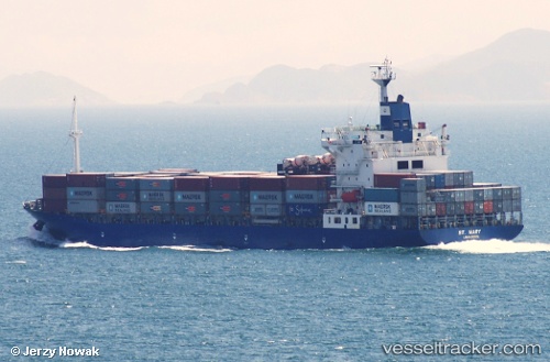
Vessel St. Mary IMO: 9219252, MMSI: 209370000 Container Ship
UTC, 13.07588, 100.88091, course: 59, speed: 0
UTC, 13.07587, 100.88094, course: 59, speed: 0
2026-02-03 16:36:14 UTC, 13.07592, 100.88092, course: 59, speed: 0
Live AIS position:
UTC. Near Tips Container Terminal),
updated 2026-02-03 16:36:14 UTC.
Find the position of the vessel St. Mary on the map. The latter are known coordinates and path.
marine traffic ship tracker show on live map
The current position of vessel St. Mary is 13.07592 lat / 100.88092 lng. Updated: 2026-02-03 16:36:14 UTCCurrently sailing under the flag of Cyprus
St. Mary built in 2001 year
Deadweight:
21579 tDetails:
Last coordinates of the vessel:
UTC, 13.07591, 100.88094, course: 59, speed: 0UTC, 13.07588, 100.88091, course: 59, speed: 0
UTC, 13.07587, 100.88094, course: 59, speed: 0
2026-02-03 16:36:14 UTC, 13.07592, 100.88092, course: 59, speed: 0