 vesseltracker.com
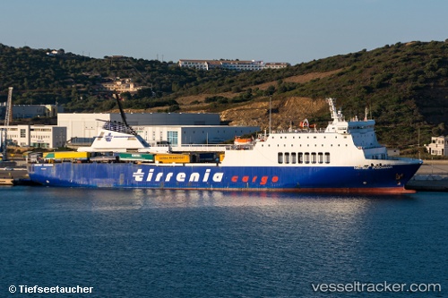
Vessel AMAL IMO: 9031686, MMSI: 209496000 Passenger/Ro-Ro Ship (vehicles)
UTC, 26.74663, 33.95027, course: 140, speed: 0
UTC, 26.74666, 33.95029, course: 140, speed: 0
2026-02-01 16:31:40 UTC, 26.68674, 34.17316, course: 142, speed: 14.8
Live AIS position:
UTC. 12 nm E of SAFAGA),
updated 2026-02-01 16:31:40 UTC.
Find the position of the vessel AMAL on the map. The latter are known coordinates and path.
marine traffic ship tracker show on live map
The current position of vessel AMAL is 26.68674 lat / 34.17316 lng. Updated: 2026-02-01 16:31:40 UTCCurrently sailing under the flag of Cyprus
AMAL built in 1993 year
Deadweight:
7330 tDetails:
Last coordinates of the vessel:
UTC, 26.74658, 33.95028, course: 140, speed: 0UTC, 26.74663, 33.95027, course: 140, speed: 0
UTC, 26.74666, 33.95029, course: 140, speed: 0
2026-02-01 16:31:40 UTC, 26.68674, 34.17316, course: 142, speed: 14.8