 vesseltracker.com
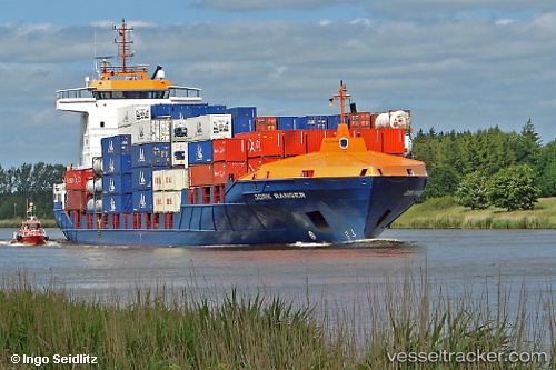
Vessel Ranger IMO: 9322542, MMSI: 209696000 Container Ship
UTC, 52.83503, -5.90224, course: 182, speed: 13.3
UTC, 52.49088, -5.89728, course: 180, speed: 13.4
2026-02-05 11:50:53 UTC, 51.99595, -5.88338, course: 181, speed: 15.5
Live AIS position:
UTC. 24 nm W of Saint David's),
updated 2026-02-05 11:50:53 UTC.
Find the position of the vessel Ranger on the map. The latter are known coordinates and path.
marine traffic ship tracker show on live map
The current position of vessel Ranger is 51.99595 lat / -5.88338 lng. Updated: 2026-02-05 11:50:53 UTCCurrently sailing under the flag of Cyprus
Ranger built in 2005 year
Deadweight:
9288 tDetails:
Last coordinates of the vessel:
UTC, 53.26452, -6.02118, course: 176, speed: 15.6UTC, 52.83503, -5.90224, course: 182, speed: 13.3
UTC, 52.49088, -5.89728, course: 180, speed: 13.4
2026-02-05 11:50:53 UTC, 51.99595, -5.88338, course: 181, speed: 15.5