 vesseltracker.com
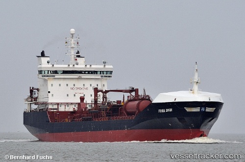
Vessel NISI IMO: 9328974, MMSI: 209848000 Oil/Chemical Tanker
UTC, 17.95625, -76.79745, course: 131, speed: 0.1
UTC, 17.95625, -76.79745, course: 131, speed: 0.1
2026-03-07 18:45:29 UTC, 17.95625, -76.79745, course: 131, speed: 0.1
Live Vessel NISI Analytics (details, animations, etc.)
Live AIS position: UTC. Near Kingston), updated 2026-03-07 18:45:29 UTC.Find the position of the vessel NISI on the map. The latter are known coordinates and path.
marine traffic ship tracker show on live map
The current position of vessel NISI is 17.95625 lat / -76.79745 lng. Updated: 2026-03-07 18:45:29 UTCCurrently sailing under the flag of Cyprus
Details:
Last coordinates of the vessel:
UTC, 17.95584, -76.79732, course: 116, speed: 0UTC, 17.95625, -76.79745, course: 131, speed: 0.1
UTC, 17.95625, -76.79745, course: 131, speed: 0.1
2026-03-07 18:45:29 UTC, 17.95625, -76.79745, course: 131, speed: 0.1