 vesseltracker.com
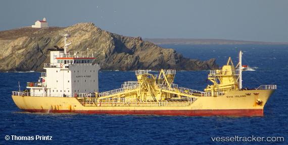
Vessel THANOS IMO: 9054731, MMSI: 209874000 Cement Carrier
UTC, 36.06333, 28.03667, course: -1, speed: 0
UTC, 36.06333, 28.03667, course: -1, speed: 0
2026-03-21 18:36:04 UTC, 36.06333, 28.03667, course: -1, speed: 0
Live Vessel THANOS Analytics (details, animations, etc.)
Live AIS position: UTC. Near Lardos Rhodes), updated 2026-03-21 18:36:04 UTC.Find the position of the vessel THANOS on the map. The latter are known coordinates and path.
marine traffic ship tracker show on live map
The current position of vessel THANOS is 36.06333 lat / 28.03667 lng. Updated: 2026-03-21 18:36:04 UTCCurrently sailing under the flag of Cyprus
THANOS built in 1992 year
Deadweight:
2218 tDetails:
Last coordinates of the vessel:
UTC, 36.06333, 28.03667, course: -1, speed: 0UTC, 36.06333, 28.03667, course: -1, speed: 0
UTC, 36.06333, 28.03667, course: -1, speed: 0
2026-03-21 18:36:04 UTC, 36.06333, 28.03667, course: -1, speed: 0