 vesseltracker.com
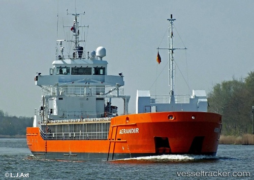
Vessel WILMA IMO: 9462744, MMSI: 209917000 General Cargo Ship
UTC, 54.61090, -5.91410, course: 218, speed: 0
UTC, 54.61092, -5.91412, course: 218, speed: 0
2026-01-14 04:04:31 UTC, 54.61098, -5.91389, course: 218, speed: 0
Live AIS position:
UTC. Near Belfast),
updated 2026-01-14 04:04:31 UTC.
Find the position of the vessel WILMA on the map. The latter are known coordinates and path.
marine traffic ship tracker show on live map
The current position of vessel WILMA is 54.61098 lat / -5.91389 lng. Updated: 2026-01-14 04:04:31 UTCCurrently sailing under the flag of Cyprus
WILMA built in 2009 year
Deadweight:
3794 tDetails:
Last coordinates of the vessel:
UTC, 54.61093, -5.91400, course: 218, speed: 0UTC, 54.61090, -5.91410, course: 218, speed: 0
UTC, 54.61092, -5.91412, course: 218, speed: 0
2026-01-14 04:04:31 UTC, 54.61098, -5.91389, course: 218, speed: 0