 vesseltracker.com
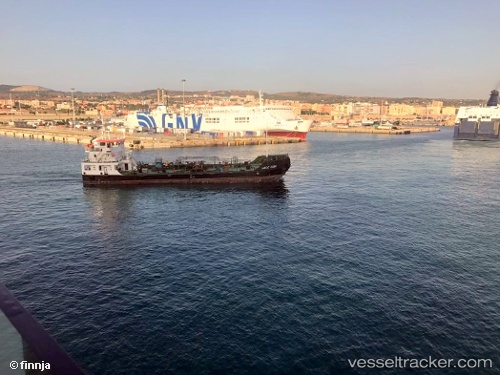
Vessel IRIS IMO: 9594119, MMSI: 209969000 Bunkering Tanker
UTC, 32.82014, 35.00617, course: -1, speed: 0.1
UTC, 32.82014, 35.00617, course: -1, speed: 0.1
2026-03-02 18:18:44 UTC, 32.81971, 35.00632, course: -1, speed: 0
Live AIS position:
UTC. Near Haifa),
updated 2026-03-02 18:18:44 UTC.
Find the position of the vessel IRIS on the map. The latter are known coordinates and path.
marine traffic ship tracker show on live map
The current position of vessel IRIS is 32.81971 lat / 35.00632 lng. Updated: 2026-03-02 18:18:44 UTCCurrently sailing under the flag of Cyprus
IRIS built in 2010 year
Deadweight:
1851 tDetails:
Last coordinates of the vessel:
UTC, 32.82014, 35.00617, course: -1, speed: 0.1UTC, 32.82014, 35.00617, course: -1, speed: 0.1
UTC, 32.82014, 35.00617, course: -1, speed: 0.1
2026-03-02 18:18:44 UTC, 32.81971, 35.00632, course: -1, speed: 0