 vesseltracker.com
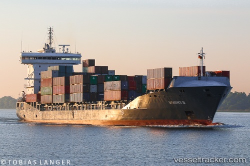
Vessel EINSTEIN IMO: 9483346, MMSI: 210101000 Container Ship
UTC, 39.96294, 0.02720, course: 11, speed: 0
UTC, 39.96333, 0.02667, course: -1, speed: 0
2026-03-03 18:15:07 UTC, 39.96294, 0.02720, course: 11, speed: 0
Live AIS position:
UTC. Near El Grao),
updated 2026-03-03 18:15:07 UTC.
Find the position of the vessel EINSTEIN on the map. The latter are known coordinates and path.
marine traffic ship tracker show on live map
The current position of vessel EINSTEIN is 39.96294 lat / 0.02720 lng. Updated: 2026-03-03 18:15:07 UTCCurrently sailing under the flag of Cyprus
EINSTEIN built in 2012 year
Deadweight:
12850 tDetails:
Last coordinates of the vessel:
UTC, 39.96294, 0.02719, course: 12, speed: 0UTC, 39.96294, 0.02720, course: 11, speed: 0
UTC, 39.96333, 0.02667, course: -1, speed: 0
2026-03-03 18:15:07 UTC, 39.96294, 0.02720, course: 11, speed: 0