vessel 'PADOSA' IMO: 9542491, vesseltracker.com
Vessel 'PADOSA' IMO: 9542491,
MMSI: 210188000 callsign: size: x

Find the position of the vessel 'PADOSA' on the map. The latter are known coordinates and path.

marine traffic ship tracker show on live map

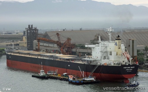
The current position of vessel 'PADOSA' is -5.54719 lat / 80.4601 lng. Updated: 2024-04-26 02:44:49 UTC
Payload_mass:
74979 tonne
Gross tonnage:
40325
Service entry:
2011-01-01T00:00:00Z

Manufacturer:
Sasebo Heavy Industries (Japanese machinery and shipbuilding company)

Details:


Last coordinates of the vessel:
UTC, -5.78957, 80.1643, course: 53, speed: 10.2
UTC, -5.77371, 80.1821, course: 44, speed: 10
UTC, -5.54719, 80.4601, course: 50, speed: 10.1
2024-04-26 02:44:49 UTC, -5.54719, 80.4601, course: 50, speed: 10.1

Track of the vessel in the last 14 days


Most frequent ports a vessels calls at 'PADOSA' (210188000):

Sambu, traffic: 3
Vlaardingen, traffic: 3
Maassluis, traffic: 3
Port Sudan, traffic: 2
Sriracha, traffic: 2
Port Adelaide, traffic: 1
Rio Grande, traffic: 1
Singapore, traffic: 1
Dagu Bar, traffic: 1
Taku Bar, traffic: 1
Djibouti, traffic: 1
Dover, traffic: 1
Sao Luiz, traffic: 1
Kobe, traffic: 1
Nansha, traffic: 1

Link to the map:


Find another ship

'PADOSA' (210188000) last ports (portcalls and passsages)

Kobe | 2024-01-10 06:59:37
Nansha | 2023-12-12 05:11:56
Dagu Bar | 2022-12-11 08:10:14
Taku Bar | 2022-12-09 05:27:56
Rio Grande | 2022-10-21 13:31:31
Port Sudan | 2022-09-17 13:46:22
Port Sudan | 2022-09-13 10:41:16
Djibouti | 2022-09-10 01:11:47
Port Adelaide | 2022-08-11 22:40:07
Sriracha | 2022-07-26 10:45:37
Sriracha | 2022-07-22 10:04:55
Sao Luiz | 2022-06-09 04:17:24
Dover | 2022-05-13 19:51:46
Vlaardingen | 2022-05-10 13:31:01
Vlaardingen | 2022-05-06 13:19:29
Maassluis | 2022-05-02 12:51:50
Singapore | 2022-01-17 15:05:40
Sambu | 2022-01-17 14:50:20