 vesseltracker.com
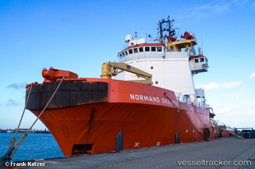
Vessel GEOQUIP SEEHORN IMO: 8406470, MMSI: 210204000 Offshore Tug/Supply Ship
UTC, 52.47414, 4.66408, course: -1, speed: 0
UTC, 52.47420, 4.66400, course: -1, speed: 0
2026-02-27 05:23:43 UTC, 52.47418, 4.66393, course: 151, speed: 0
Live AIS position:
UTC. Near BEVERWIJK),
updated 2026-02-27 05:23:43 UTC.
Find the position of the vessel GEOQUIP SEEHORN on the map. The latter are known coordinates and path.
marine traffic ship tracker show on live map
The current position of vessel GEOQUIP SEEHORN is 52.47418 lat / 4.66393 lng. Updated: 2026-02-27 05:23:43 UTCCurrently sailing under the flag of Cyprus
GEOQUIP SEEHORN built in 1985 year
Deadweight:
2500 tDetails:
Last coordinates of the vessel:
UTC, 52.47415, 4.66400, course: 152, speed: 0UTC, 52.47414, 4.66408, course: -1, speed: 0
UTC, 52.47420, 4.66400, course: -1, speed: 0
2026-02-27 05:23:43 UTC, 52.47418, 4.66393, course: 151, speed: 0