 vesseltracker.com
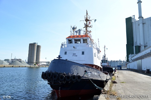
Vessel MASTER IMO: 7711799, MMSI: 210391000 Tug
UTC, 42.93525, 10.54276, course: 85, speed: 0
UTC, 42.93500, 10.54167, course: -1, speed: 0
2026-01-14 00:50:51 UTC, 42.93525, 10.54275, course: 84, speed: 0
Live AIS position:
UTC. Near PIOMBINO),
updated 2026-01-14 00:50:51 UTC.
Find the position of the vessel MASTER on the map. The latter are known coordinates and path.
marine traffic ship tracker show on live map
The current position of vessel MASTER is 42.93525 lat / 10.54275 lng. Updated: 2026-01-14 00:50:51 UTCCurrently sailing under the flag of Cyprus
MASTER built in 1978 year
Deadweight:
0 tDetails:
Last coordinates of the vessel:
UTC, 42.93524, 10.54275, course: 85, speed: 0UTC, 42.93525, 10.54276, course: 85, speed: 0
UTC, 42.93500, 10.54167, course: -1, speed: 0
2026-01-14 00:50:51 UTC, 42.93525, 10.54275, course: 84, speed: 0