 vesseltracker.com
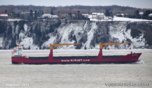
Vessel PUKA IMO: 9374973, MMSI: 210517000 General Cargo
UTC, 16.20546, -61.54421, course: 114, speed: 0.6
UTC, 16.20500, -61.54333, course: -1, speed: 1
2026-03-02 03:30:11 UTC, 16.20645, -61.54383, course: 139, speed: 0.3
Live AIS position:
UTC. Near Pointe A Pitre),
updated 2026-03-02 03:30:11 UTC.
Find the position of the vessel PUKA on the map. The latter are known coordinates and path.
marine traffic ship tracker show on live map
The current position of vessel PUKA is 16.20645 lat / -61.54383 lng. Updated: 2026-03-02 03:30:11 UTCDetails:
Last coordinates of the vessel:
UTC, 16.20667, -61.54333, course: -1, speed: 0UTC, 16.20546, -61.54421, course: 114, speed: 0.6
UTC, 16.20500, -61.54333, course: -1, speed: 1
2026-03-02 03:30:11 UTC, 16.20645, -61.54383, course: 139, speed: 0.3