 vesseltracker.com
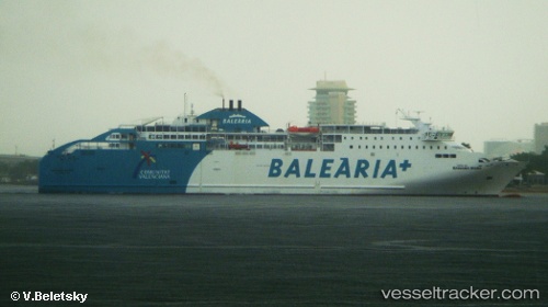
Vessel BAHAMA MAMA IMO: 9441142, MMSI: 210567000 Ro-Ro/Passenger Ship
UTC, 35.88888, -5.51785, course: 12, speed: 14.6
UTC, 36.15150, -5.42552, course: 258, speed: 13.7
2026-02-22 16:17:47 UTC, 36.01160, -5.43003, course: 224, speed: 19.4
Live AIS position:
UTC. Near Algeciras),
updated 2026-02-22 16:17:47 UTC.
Find the position of the vessel BAHAMA MAMA on the map. The latter are known coordinates and path.
marine traffic ship tracker show on live map
The current position of vessel BAHAMA MAMA is 36.01160 lat / -5.43003 lng. Updated: 2026-02-22 16:17:47 UTCDetails:
Last coordinates of the vessel:
UTC, 35.94128, -5.51680, course: 197, speed: 17.4UTC, 35.88888, -5.51785, course: 12, speed: 14.6
UTC, 36.15150, -5.42552, course: 258, speed: 13.7
2026-02-22 16:17:47 UTC, 36.01160, -5.43003, course: 224, speed: 19.4