 vesseltracker.com
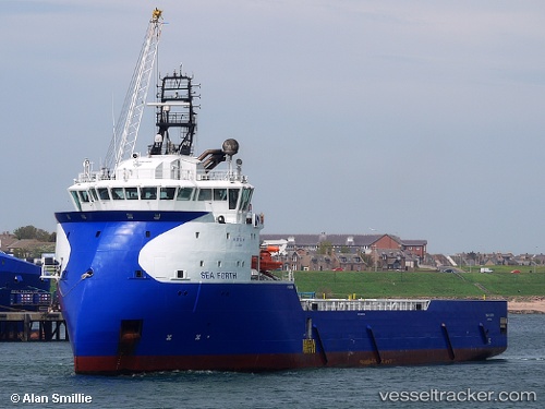
Vessel Sea Forth IMO: 9656723, MMSI: 210738000 Offshore Tug Supply Ship
UTC, -25.50062, -48.50069, course: 261, speed: 0
UTC, -25.50065, -48.50066, course: 262, speed: 0
2026-02-20 06:08:10 UTC, -25.50059, -48.50067, course: 262, speed: 0
Live AIS position:
UTC. Near Paranagua),
updated 2026-02-20 06:08:10 UTC.
Find the position of the vessel Sea Forth on the map. The latter are known coordinates and path.
marine traffic ship tracker show on live map
The current position of vessel Sea Forth is -25.50059 lat / -48.50067 lng. Updated: 2026-02-20 06:08:10 UTCCurrently sailing under the flag of Cyprus
Sea Forth built in 2013 year
Deadweight:
4700 tDetails:
Last coordinates of the vessel:
UTC, -25.50062, -48.50063, course: 262, speed: 0UTC, -25.50062, -48.50069, course: 261, speed: 0
UTC, -25.50065, -48.50066, course: 262, speed: 0
2026-02-20 06:08:10 UTC, -25.50059, -48.50067, course: 262, speed: 0