 vesseltracker.com
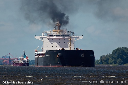
Vessel Andreas K IMO: 9438121, MMSI: 210875000 Bulk Carrier
UTC, 22.68643, 59.84902, course: 137, speed: 11.8
UTC, 22.43957, 59.98685, course: 179, speed: 11.9
2026-02-01 07:32:13 UTC, 22.11617, 60.09025, course: 163, speed: 11.8
Live AIS position:
UTC. 41 nm SE of SUR),
updated 2026-02-01 07:32:13 UTC.
Find the position of the vessel Andreas K on the map. The latter are known coordinates and path.
marine traffic ship tracker show on live map
The current position of vessel Andreas K is 22.11617 lat / 60.09025 lng. Updated: 2026-02-01 07:32:13 UTCDetails:
Last coordinates of the vessel:
UTC, 23.03375, 59.52858, course: 139, speed: 11.2UTC, 22.68643, 59.84902, course: 137, speed: 11.8
UTC, 22.43957, 59.98685, course: 179, speed: 11.9
2026-02-01 07:32:13 UTC, 22.11617, 60.09025, course: 163, speed: 11.8