 vesseltracker.com
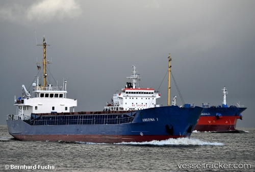
Vessel ANTONIA B IMO: 8919221, MMSI: 211100000 General Cargo Ship
UTC, 53.44385, 14.58260, course: 18, speed: 0
UTC, 53.47601, 14.61006, course: 41, speed: 7.5
2026-03-11 15:50:14 UTC, 53.74430, 14.42482, course: 322, speed: 9.8
Live Vessel ANTONIA B Analytics (details, animations, etc.)
Live AIS position: UTC. Near Nowe Warpno), updated 2026-03-11 15:50:14 UTC.Find the position of the vessel ANTONIA B on the map. The latter are known coordinates and path.
marine traffic ship tracker show on live map
The current position of vessel ANTONIA B is 53.74430 lat / 14.42482 lng. Updated: 2026-03-11 15:50:14 UTCCurrently sailing under the flag of Germany
ANTONIA B built in 1990 year
Deadweight:
1946 tDetails:
Last coordinates of the vessel:
UTC, 53.44385, 14.58259, course: 18, speed: 0UTC, 53.44385, 14.58260, course: 18, speed: 0
UTC, 53.47601, 14.61006, course: 41, speed: 7.5
2026-03-11 15:50:14 UTC, 53.74430, 14.42482, course: 322, speed: 9.8