 vesseltracker.com
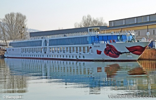
Vessel A Rosa Mia IMO: 8979283, MMSI: 211160700 Passenger Ship
UTC, 48.23347, 15.32690, course: -1, speed: 0
UTC, 48.23348, 15.32690, course: -1, speed: 0
2026-03-24 20:12:46 UTC, 48.21219, 15.14446, course: -1, speed: 7.2
Live Vessel A Rosa Mia Analytics (details, animations, etc.)
Live AIS position: UTC. Near Granz), updated 2026-03-24 20:12:46 UTC.Find the position of the vessel A Rosa Mia on the map. The latter are known coordinates and path.
marine traffic ship tracker show on live map
The current position of vessel A Rosa Mia is 48.21219 lat / 15.14446 lng. Updated: 2026-03-24 20:12:46 UTCCurrently sailing under the flag of Germany
Details:
Last coordinates of the vessel:
UTC, 48.23347, 15.32691, course: -1, speed: 0UTC, 48.23347, 15.32690, course: -1, speed: 0
UTC, 48.23348, 15.32690, course: -1, speed: 0
2026-03-24 20:12:46 UTC, 48.21219, 15.14446, course: -1, speed: 7.2