 vesseltracker.com
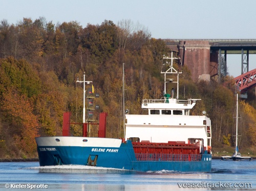
Vessel Selene Prahm IMO: 9100059, MMSI: 211219630 Multi Purpose Carrier
UTC, 53.94708, 8.64640, course: 310, speed: 12.8
UTC, 54.02697, 8.12858, course: 274, speed: 7.9
2026-03-05 21:28:56 UTC, 54.13987, 7.73991, course: 298, speed: 7.3
Live Vessel Selene Prahm Analytics (details, animations, etc.)
Live AIS position: UTC. Near Helgoland), updated 2026-03-05 21:28:56 UTC.Find the position of the vessel Selene Prahm on the map. The latter are known coordinates and path.
marine traffic ship tracker show on live map
The current position of vessel Selene Prahm is 54.13987 lat / 7.73991 lng. Updated: 2026-03-05 21:28:56 UTCCurrently sailing under the flag of Germany
Selene Prahm built in 1994 year
Deadweight:
2422 tDetails:
Last coordinates of the vessel:
UTC, 53.89033, 9.13744, course: 232, speed: 5.7UTC, 53.94708, 8.64640, course: 310, speed: 12.8
UTC, 54.02697, 8.12858, course: 274, speed: 7.9
2026-03-05 21:28:56 UTC, 54.13987, 7.73991, course: 298, speed: 7.3