 vesseltracker.com
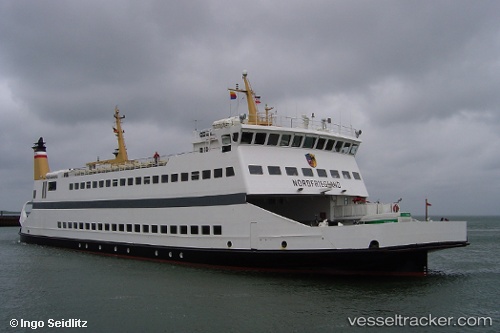
Vessel Nordfriesland IMO: 9102758, MMSI: 211222960 Passenger Ro Ro Cargo Ship
UTC, 54.70827, 8.65132, course: 42, speed: 7.9
UTC, 54.67981, 8.61556, course: 13, speed: 10.9
2026-03-04 09:53:51 UTC, 54.68949, 8.58403, course: 149, speed: 9.2
Live Vessel Nordfriesland Analytics (details, animations, etc.)
Live AIS position: UTC. Near Alkersum), updated 2026-03-04 09:53:51 UTC.Find the position of the vessel Nordfriesland on the map. The latter are known coordinates and path.
marine traffic ship tracker show on live map
The current position of vessel Nordfriesland is 54.68949 lat / 8.58403 lng. Updated: 2026-03-04 09:53:51 UTCCurrently sailing under the flag of Germany
Nordfriesland built in 1995 year
Deadweight:
370 tDetails:
Last coordinates of the vessel:
UTC, 54.64259, 8.43621, course: 40, speed: 8.6UTC, 54.70827, 8.65132, course: 42, speed: 7.9
UTC, 54.67981, 8.61556, course: 13, speed: 10.9
2026-03-04 09:53:51 UTC, 54.68949, 8.58403, course: 149, speed: 9.2