 vesseltracker.com
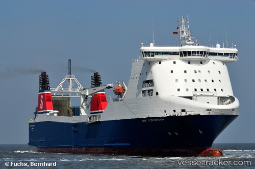
Vessel Msc Bridge IMO: 9138783, MMSI: 212184000 Ro Ro Cargo Ship
UTC, 36.83970, 10.52332, course: 131, speed: 0.4
UTC, 36.84004, 10.52378, course: 119, speed: 0.4
2026-01-19 01:35:25 UTC, 36.83928, 10.52332, course: 142, speed: 0.4
Live AIS position:
UTC. Near Al Marsá),
updated 2026-01-19 01:35:25 UTC.
Find the position of the vessel Msc Bridge on the map. The latter are known coordinates and path.
marine traffic ship tracker show on live map
The current position of vessel Msc Bridge is 36.83928 lat / 10.52332 lng. Updated: 2026-01-19 01:35:25 UTCCurrently sailing under the flag of Cyprus
Msc Bridge built in 1998 year
Deadweight:
12350 tDetails:
Last coordinates of the vessel:
UTC, 36.83919, 10.52346, course: 104, speed: 0.3UTC, 36.83970, 10.52332, course: 131, speed: 0.4
UTC, 36.84004, 10.52378, course: 119, speed: 0.4
2026-01-19 01:35:25 UTC, 36.83928, 10.52332, course: 142, speed: 0.4