 vesseltracker.com
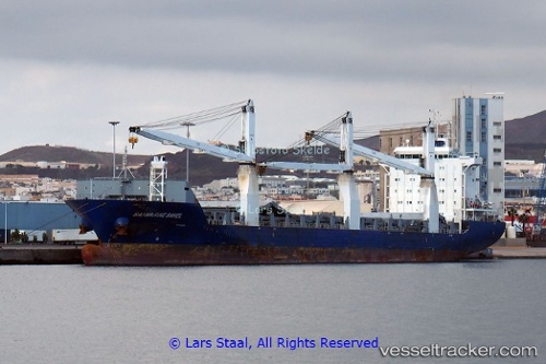
Vessel CONDOR MAGALLANES IMO: 9539365, MMSI: 212303000 General Cargo
UTC, 42.23032, -8.74394, course: 240, speed: 0
UTC, 42.23034, -8.74396, course: 240, speed: 0
2026-02-23 20:00:20 UTC, 42.46460, -9.19950, course: 308, speed: 13.4
Live AIS position:
UTC. 10 nm SW of Ribeira (Santa Uxia)),
updated 2026-02-23 20:00:20 UTC.
Find the position of the vessel CONDOR MAGALLANES on the map. The latter are known coordinates and path.
marine traffic ship tracker show on live map
The current position of vessel CONDOR MAGALLANES is 42.46460 lat / -9.19950 lng. Updated: 2026-02-23 20:00:20 UTCCurrently sailing under the flag of Cyprus
Details:
Last coordinates of the vessel:
UTC, 42.23025, -8.74409, course: 240, speed: 0UTC, 42.23032, -8.74394, course: 240, speed: 0
UTC, 42.23034, -8.74396, course: 240, speed: 0
2026-02-23 20:00:20 UTC, 42.46460, -9.19950, course: 308, speed: 13.4