 vesseltracker.com
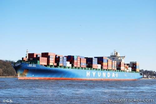
Vessel Hyundai Busan IMO: 9305659, MMSI: 212350000 Container Ship
UTC, 35.09295, -130.10812, course: 293, speed: 19
UTC, 35.32970, -130.78548, course: 294, speed: 18.7
2026-01-31 13:44:13 UTC, 35.63698, -131.60533, course: 294, speed: 18.7
Live AIS position:
UTC. 193 nm SW of Volcano),
updated 2026-01-31 13:44:13 UTC.
Find the position of the vessel Hyundai Busan on the map. The latter are known coordinates and path.
marine traffic ship tracker show on live map
The current position of vessel Hyundai Busan is 35.63698 lat / -131.60533 lng. Updated: 2026-01-31 13:44:13 UTCCurrently sailing under the flag of Cyprus
Hyundai Busan built in 2006 year
Deadweight:
80102 tDetails:
Last coordinates of the vessel:
UTC, 34.98923, -129.52914, course: 280, speed: 19.1UTC, 35.09295, -130.10812, course: 293, speed: 19
UTC, 35.32970, -130.78548, course: 294, speed: 18.7
2026-01-31 13:44:13 UTC, 35.63698, -131.60533, course: 294, speed: 18.7