 vesseltracker.com
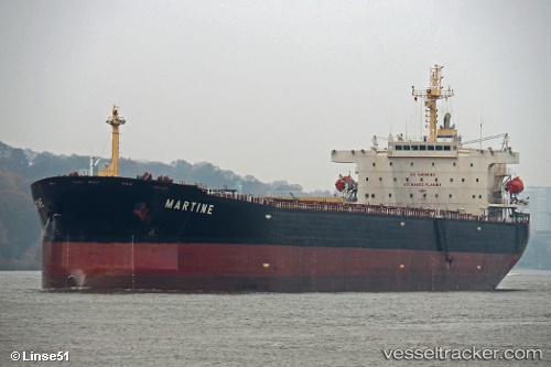
Vessel Martine IMO: 9411537, MMSI: 212555000 Bulk Carrier
UTC, 34.84642, 136.95268, course: 352, speed: 0
UTC, 34.84635, 136.95270, course: 352, speed: 0
2026-01-30 15:37:37 UTC, 34.84645, 136.95271, course: 352, speed: 0
Live AIS position:
UTC. Near Kinuura),
updated 2026-01-30 15:37:37 UTC.
Find the position of the vessel Martine on the map. The latter are known coordinates and path.
marine traffic ship tracker show on live map
The current position of vessel Martine is 34.84645 lat / 136.95271 lng. Updated: 2026-01-30 15:37:37 UTCCurrently sailing under the flag of Cyprus
Martine built in 2009 year
Deadweight:
86800 tDetails:
Last coordinates of the vessel:
UTC, 34.84643, 136.95271, course: 352, speed: 0.1UTC, 34.84642, 136.95268, course: 352, speed: 0
UTC, 34.84635, 136.95270, course: 352, speed: 0
2026-01-30 15:37:37 UTC, 34.84645, 136.95271, course: 352, speed: 0