 vesseltracker.com
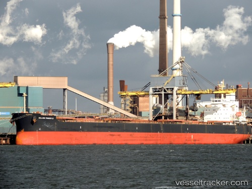
Vessel Aeolian Light IMO: 9323053, MMSI: 212684000 Bulk Carrier
UTC, 10.59780, 107.02350, course: 335, speed: 0
UTC, 10.59780, 107.02357, course: 335, speed: 0
2026-03-03 18:10:14 UTC, 10.59788, 107.02355, course: 335, speed: 0
Live AIS position:
UTC. Near Saigon ITV/Phu My),
updated 2026-03-03 18:10:14 UTC.
Find the position of the vessel Aeolian Light on the map. The latter are known coordinates and path.
marine traffic ship tracker show on live map
The current position of vessel Aeolian Light is 10.59788 lat / 107.02355 lng. Updated: 2026-03-03 18:10:14 UTCCurrently sailing under the flag of Cyprus
Aeolian Light built in 2007 year
Deadweight:
82014 tDetails:
Last coordinates of the vessel:
UTC, 10.59777, 107.02343, course: 335, speed: 0UTC, 10.59780, 107.02350, course: 335, speed: 0
UTC, 10.59780, 107.02357, course: 335, speed: 0
2026-03-03 18:10:14 UTC, 10.59788, 107.02355, course: 335, speed: 0