 vesseltracker.com
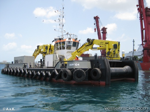
Vessel Bkm 104 IMO: 9556935, MMSI: 212685000 Utility Vessel
UTC, 25.71096, 55.80036, course: -1, speed: 0.2
UTC, 25.71099, 55.80013, course: -1, speed: 0
2026-03-15 21:39:22 UTC, 25.71105, 55.80011, course: -1, speed: 0
Live Vessel Bkm 104 Analytics (details, animations, etc.)
Live AIS position: UTC. Near Al Jazeera Port), updated 2026-03-15 21:39:22 UTC.Find the position of the vessel Bkm 104 on the map. The latter are known coordinates and path.
marine traffic ship tracker show on live map
The current position of vessel Bkm 104 is 25.71105 lat / 55.80011 lng. Updated: 2026-03-15 21:39:22 UTCDetails:
Last coordinates of the vessel:
UTC, 25.71101, 55.80009, course: -1, speed: 0UTC, 25.71096, 55.80036, course: -1, speed: 0.2
UTC, 25.71099, 55.80013, course: -1, speed: 0
2026-03-15 21:39:22 UTC, 25.71105, 55.80011, course: -1, speed: 0