 vesseltracker.com
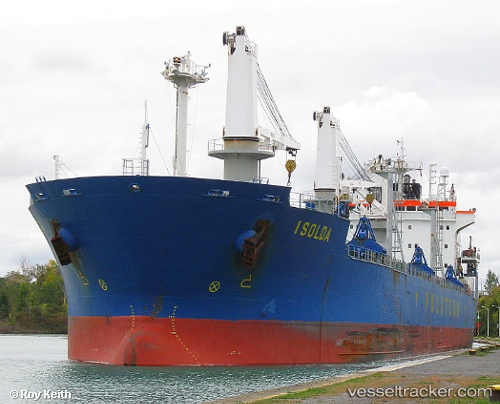
Vessel Isolda IMO: 9180360, MMSI: 212797000 Bulk Carrier
UTC, 55.53150, 9.92389, course: 97, speed: 0.4
UTC, 55.53138, 9.92386, course: 78, speed: 0.1
2026-02-03 18:31:05 UTC, 55.67088, 10.22821, course: 88, speed: 8.8
Live AIS position:
UTC. Near Juelsminde),
updated 2026-02-03 18:31:05 UTC.
Find the position of the vessel Isolda on the map. The latter are known coordinates and path.
marine traffic ship tracker show on live map
The current position of vessel Isolda is 55.67088 lat / 10.22821 lng. Updated: 2026-02-03 18:31:05 UTCCurrently sailing under the flag of Cyprus
Isolda built in 1999 year
Deadweight:
34949 tDetails:
Last coordinates of the vessel:
UTC, 55.53162, 9.92392, course: 87, speed: 0.2UTC, 55.53150, 9.92389, course: 97, speed: 0.4
UTC, 55.53138, 9.92386, course: 78, speed: 0.1
2026-02-03 18:31:05 UTC, 55.67088, 10.22821, course: 88, speed: 8.8