 vesseltracker.com
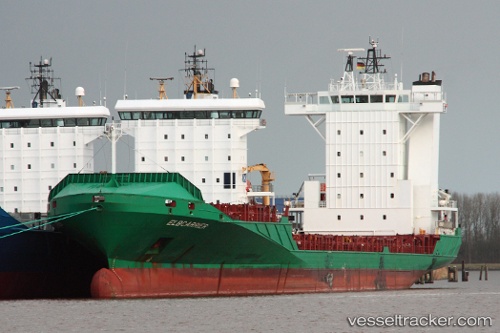
Vessel Elbcarrier IMO: 9388510, MMSI: 212935000 Container Ship
UTC, 50.53979, -0.06444, course: 258, speed: 13.2
UTC, 50.50540, -0.31851, course: 256, speed: 13.3
2026-01-17 02:08:42 UTC, 50.38973, -1.24686, course: 257, speed: 13.2
Live AIS position:
UTC. Near Holbury),
updated 2026-01-17 02:08:42 UTC.
Find the position of the vessel Elbcarrier on the map. The latter are known coordinates and path.
marine traffic ship tracker show on live map
The current position of vessel Elbcarrier is 50.38973 lat / -1.24686 lng. Updated: 2026-01-17 02:08:42 UTCCurrently sailing under the flag of Cyprus
Elbcarrier built in 2007 year
Deadweight:
11166 tDetails:
Last coordinates of the vessel:
UTC, 50.57935, 0.27356, course: 259, speed: 13.2UTC, 50.53979, -0.06444, course: 258, speed: 13.2
UTC, 50.50540, -0.31851, course: 256, speed: 13.3
2026-01-17 02:08:42 UTC, 50.38973, -1.24686, course: 257, speed: 13.2