 vesseltracker.com
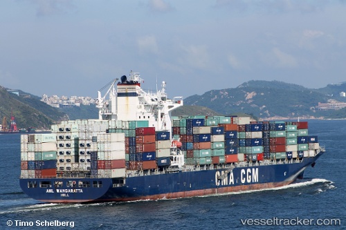
Vessel Anl Wangaratta IMO: 9334167, MMSI: 215167000 Container Ship
UTC, 35.4317, 139.731, course: 121, speed: 0
UTC, 35.4312, 139.731, course: 105, speed: 0
2026-03-14 18:04:01 UTC, 35.429, 139.731, course: 36, speed: 0.1
Live Vessel Anl Wangaratta Analytics (details, animations, etc.)
Live AIS position: UTC. Near Yamashitacho), updated 2026-03-14 18:04:01 UTC.Find the position of the vessel Anl Wangaratta on the map. The latter are known coordinates and path.
marine traffic ship tracker show on live map
The current position of vessel Anl Wangaratta is 35.429 lat / 139.731 lng. Updated: 2026-03-14 18:04:01 UTCDetails:
Last coordinates of the vessel:
UTC, 35.4299, 139.731, course: 79, speed: 0UTC, 35.4317, 139.731, course: 121, speed: 0
UTC, 35.4312, 139.731, course: 105, speed: 0
2026-03-14 18:04:01 UTC, 35.429, 139.731, course: 36, speed: 0.1