 vesseltracker.com
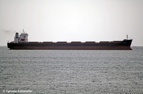
Vessel SEAPOWER I IMO: 9214331, MMSI: 215480000 Bulk Carrier
UTC, 18.9308, 39.0874, course: 153, speed: 12.4
UTC, 18.7559, 39.1782, course: 155, speed: 7
2026-03-04 10:13:04 UTC, 18.3778, 39.4783, course: 149, speed: 12.1
Live Vessel SEAPOWER I Analytics (details, animations, etc.)
Live AIS position: UTC. 101 nm SW of Al Qunfudah), updated 2026-03-04 10:13:04 UTC.Find the position of the vessel SEAPOWER I on the map. The latter are known coordinates and path.
marine traffic ship tracker show on live map
The current position of vessel SEAPOWER I is 18.3778 lat / 39.4783 lng. Updated: 2026-03-04 10:13:04 UTCCurrently sailing under the flag of Malta
SEAPOWER I built in 2001 year
Deadweight:
74665 tDetails:
Last coordinates of the vessel:
UTC, 19.4281, 38.8158, course: 154, speed: 11.9UTC, 18.9308, 39.0874, course: 153, speed: 12.4
UTC, 18.7559, 39.1782, course: 155, speed: 7
2026-03-04 10:13:04 UTC, 18.3778, 39.4783, course: 149, speed: 12.1