 vesseltracker.com
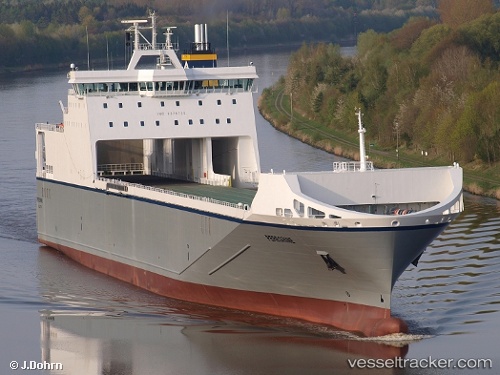
Vessel Peregrine IMO: 9376725, MMSI: 215740000 Ro Ro Cargo Ship
UTC, 53.5902, -4.48069, course: 98, speed: 15.9
UTC, 53.517, -3.64848, course: 93, speed: 15.1
2026-03-10 19:29:43 UTC, 53.5302, -3.15565, course: 92, speed: 12.9
Live Vessel Peregrine Analytics (details, animations, etc.)
Live AIS position: UTC. Near Hightown), updated 2026-03-10 19:29:43 UTC.Find the position of the vessel Peregrine on the map. The latter are known coordinates and path.
marine traffic ship tracker show on live map
The current position of vessel Peregrine is 53.5302 lat / -3.15565 lng. Updated: 2026-03-10 19:29:43 UTCCurrently sailing under the flag of Malta
Peregrine built in 2010 year
Deadweight:
14538 tDetails:
Last coordinates of the vessel:
UTC, 53.4473, -5.13457, course: 63, speed: 13UTC, 53.5902, -4.48069, course: 98, speed: 15.9
UTC, 53.517, -3.64848, course: 93, speed: 15.1
2026-03-10 19:29:43 UTC, 53.5302, -3.15565, course: 92, speed: 12.9