 vesseltracker.com
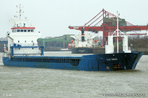
Vessel KAATA IMO: 9184823, MMSI: 215908000 General Cargo Ship
UTC, 55.4223, 12.647, course: 192, speed: 11
UTC, 55.3931, 12.6376, course: 188, speed: 10.9
2026-01-13 17:34:26 UTC, 54.8856, 12.5531, course: 202, speed: 3.9
Live AIS position:
UTC. Near Stará Voda),
updated 2026-01-13 17:34:26 UTC.
Find the position of the vessel KAATA on the map. The latter are known coordinates and path.
marine traffic ship tracker show on live map
The current position of vessel KAATA is 54.8856 lat / 12.5531 lng. Updated: 2026-01-13 17:34:26 UTCCurrently sailing under the flag of Malta
KAATA built in 1999 year
Deadweight:
5049 tDetails:
Last coordinates of the vessel:
UTC, 55.7883, 12.689, course: 192, speed: 10.3UTC, 55.4223, 12.647, course: 192, speed: 11
UTC, 55.3931, 12.6376, course: 188, speed: 10.9
2026-01-13 17:34:26 UTC, 54.8856, 12.5531, course: 202, speed: 3.9