 vesseltracker.com
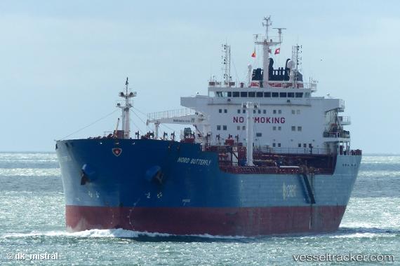
Vessel CLOTILDE IMO: 9448310, MMSI: 215910000 Chemical/Oil Products Tanker
UTC, 36.9406, 6.93207, course: 232, speed: 0
UTC, 36.9383, 6.93167, course: -1, speed: 0
2026-02-04 16:01:29 UTC, 36.9383, 6.93167, course: -1, speed: 0
Live AIS position:
UTC. Near Skikda),
updated 2026-02-04 16:01:29 UTC.
Find the position of the vessel CLOTILDE on the map. The latter are known coordinates and path.
marine traffic ship tracker show on live map
The current position of vessel CLOTILDE is 36.9383 lat / 6.93167 lng. Updated: 2026-02-04 16:01:29 UTCCurrently sailing under the flag of Malta
CLOTILDE built in 2008 year
Deadweight:
38431 tDetails:
Last coordinates of the vessel:
UTC, 36.9409, 6.93177, course: 221, speed: 0.1UTC, 36.9406, 6.93207, course: 232, speed: 0
UTC, 36.9383, 6.93167, course: -1, speed: 0
2026-02-04 16:01:29 UTC, 36.9383, 6.93167, course: -1, speed: 0