 vesseltracker.com
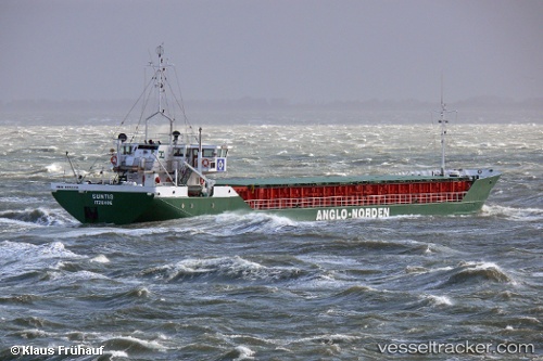
Vessel Suntis IMO: 8513314, MMSI: 218005000 Multi Purpose Carrier
UTC, 51.9945, 1.59285, course: 207, speed: 7.3
UTC, 51.9485, 1.42722, course: 279, speed: 3
2026-01-31 13:27:06 UTC, 51.9498, 1.42761, course: 216, speed: 0
Live AIS position:
UTC. Near Boxford),
updated 2026-01-31 13:27:06 UTC.
Find the position of the vessel Suntis on the map. The latter are known coordinates and path.
marine traffic ship tracker show on live map
The current position of vessel Suntis is 51.9498 lat / 1.42761 lng. Updated: 2026-01-31 13:27:06 UTCCurrently sailing under the flag of Germany
Suntis built in 1985 year
Deadweight:
1815 tDetails:
Last coordinates of the vessel:
UTC, 52.2994, 2.09576, course: 219, speed: 10.6UTC, 51.9945, 1.59285, course: 207, speed: 7.3
UTC, 51.9485, 1.42722, course: 279, speed: 3
2026-01-31 13:27:06 UTC, 51.9498, 1.42761, course: 216, speed: 0