 vesseltracker.com
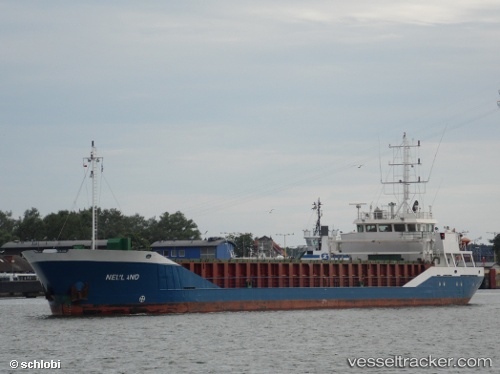
Vessel Neuland IMO: 9117959, MMSI: 218492000 Multi Purpose Carrier
UTC, 53.9764, 8.50616, course: 284, speed: 10.2
UTC, 54.0171, 7.66782, course: 254, speed: 9.8
2026-02-28 14:17:46 UTC, 53.9399, 7.17415, course: 257, speed: 8.9
Live AIS position:
UTC. 14 nm NW of Baltrum),
updated 2026-02-28 14:17:46 UTC.
Find the position of the vessel Neuland on the map. The latter are known coordinates and path.
marine traffic ship tracker show on live map
The current position of vessel Neuland is 53.9399 lat / 7.17415 lng. Updated: 2026-02-28 14:17:46 UTCDetails:
Last coordinates of the vessel:
UTC, 53.8419, 8.85948, course: 267, speed: 6.6UTC, 53.9764, 8.50616, course: 284, speed: 10.2
UTC, 54.0171, 7.66782, course: 254, speed: 9.8
2026-02-28 14:17:46 UTC, 53.9399, 7.17415, course: 257, speed: 8.9