 vesseltracker.com
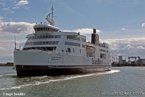
Vessel Prins Richard IMO: 9144419, MMSI: 219000429 Passenger Ro Ro Cargo Ship
UTC, 54.5033, 11.2276, course: 35, speed: 0
UTC, 54.5298, 11.2518, course: 21, speed: 14.6
2026-03-17 03:52:28 UTC, 54.5033, 11.2276, course: 35, speed: 0
Live Vessel Prins Richard Analytics (details, animations, etc.)
Live AIS position: UTC. Near Bannesdorf), updated 2026-03-17 03:52:28 UTC.Find the position of the vessel Prins Richard on the map. The latter are known coordinates and path.
marine traffic ship tracker show on live map
The current position of vessel Prins Richard is 54.5033 lat / 11.2276 lng. Updated: 2026-03-17 03:52:28 UTCCurrently sailing under the flag of Denmark
Prins Richard built in 1997 year
Deadweight:
2490 tDetails:
Last coordinates of the vessel:
UTC, 54.5026, 11.2268, course: 215, speed: 0UTC, 54.5033, 11.2276, course: 35, speed: 0
UTC, 54.5298, 11.2518, course: 21, speed: 14.6
2026-03-17 03:52:28 UTC, 54.5033, 11.2276, course: 35, speed: 0