 vesseltracker.com
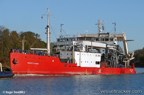
Vessel Henry P. Lading IMO: 8646484, MMSI: 219002349 Cable Layer
UTC, 56.2109, 12.3812, course: 293, speed: 4.1
UTC, 56.2346, 12.0534, course: 276, speed: 4.6
2026-03-10 18:03:36 UTC, 56.2468, 11.7442, course: 264, speed: 5.2
Live Vessel Henry P. Lading Analytics (details, animations, etc.)
Live AIS position: UTC. 16 nm N of Masnedsund), updated 2026-03-10 18:03:36 UTC.Find the position of the vessel Henry P. Lading on the map. The latter are known coordinates and path.
marine traffic ship tracker show on live map
The current position of vessel Henry P. Lading is 56.2468 lat / 11.7442 lng. Updated: 2026-03-10 18:03:36 UTCDetails:
Last coordinates of the vessel:
UTC, 56.1321, 12.5331, course: 313, speed: 4.8UTC, 56.2109, 12.3812, course: 293, speed: 4.1
UTC, 56.2346, 12.0534, course: 276, speed: 4.6
2026-03-10 18:03:36 UTC, 56.2468, 11.7442, course: 264, speed: 5.2