 vesseltracker.com
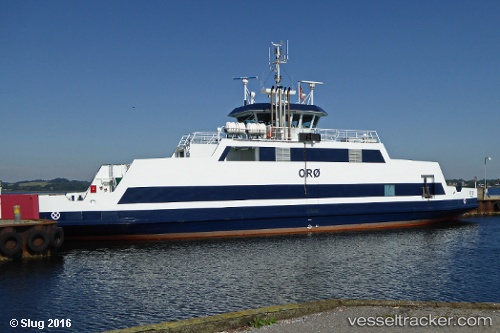
Vessel Oroe IMO: 9287613, MMSI: 219003141 Passenger Ro Ro Cargo Ship
UTC, 55.7211, 11.7087, course: 219, speed: 0
UTC, 55.721, 11.7087, course: 219, speed: 0
2026-02-04 03:35:42 UTC, 55.7254, 11.7202, course: 64, speed: 6.2
Live AIS position:
UTC. Near Gislinge),
updated 2026-02-04 03:35:42 UTC.
Find the position of the vessel Oroe on the map. The latter are known coordinates and path.
marine traffic ship tracker show on live map
The current position of vessel Oroe is 55.7254 lat / 11.7202 lng. Updated: 2026-02-04 03:35:42 UTCCurrently sailing under the flag of Denmark
Oroe built in 2003 year
Deadweight:
125 tDetails:
Last coordinates of the vessel:
UTC, 55.7211, 11.7087, course: 219, speed: 0UTC, 55.7211, 11.7087, course: 219, speed: 0
UTC, 55.721, 11.7087, course: 219, speed: 0
2026-02-04 03:35:42 UTC, 55.7254, 11.7202, course: 64, speed: 6.2