 vesseltracker.com
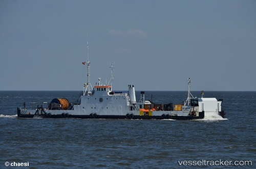
Vessel Mira A IMO: 9099171, MMSI: 219012076 Deck Cargo Ship
UTC, 55.05924, 10.62131, course: 122, speed: 0
UTC, 55.05922, 10.62131, course: 122, speed: 0
2026-03-10 18:01:15 UTC, 55.05923, 10.62130, course: 122, speed: 0
Live Vessel Mira A Analytics (details, animations, etc.)
Live AIS position: UTC. Near Svendborg), updated 2026-03-10 18:01:15 UTC.Find the position of the vessel Mira A on the map. The latter are known coordinates and path.
marine traffic ship tracker show on live map
The current position of vessel Mira A is 55.05923 lat / 10.62130 lng. Updated: 2026-03-10 18:01:15 UTCCurrently sailing under the flag of Denmark
Mira A built in 1969 year
Deadweight:
200 tDetails:
Last coordinates of the vessel:
UTC, 55.05924, 10.62130, course: 121, speed: 0UTC, 55.05924, 10.62131, course: 122, speed: 0
UTC, 55.05922, 10.62131, course: 122, speed: 0
2026-03-10 18:01:15 UTC, 55.05923, 10.62130, course: 122, speed: 0