 vesseltracker.com
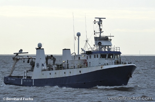
Vessel Arne Tiselius IMO: 7517624, MMSI: 219012162 Fishing Support Vessel
UTC, 54.50966, 13.63513, course: 231, speed: 0.1
UTC, 54.50966, 13.63514, course: 231, speed: 0.1
2026-01-16 13:58:21 UTC, 54.50966, 13.63514, course: 230, speed: 0.1
Live AIS position:
UTC. Near SASSNITZ),
updated 2026-01-16 13:58:21 UTC.
Find the position of the vessel Arne Tiselius on the map. The latter are known coordinates and path.
marine traffic ship tracker show on live map
The current position of vessel Arne Tiselius is 54.50966 lat / 13.63514 lng. Updated: 2026-01-16 13:58:21 UTCCurrently sailing under the flag of Denmark
Arne Tiselius built in 1976 year
Details:
Last coordinates of the vessel:
UTC, 54.50966, 13.63510, course: 230, speed: 0.1UTC, 54.50966, 13.63513, course: 231, speed: 0.1
UTC, 54.50966, 13.63514, course: 231, speed: 0.1
2026-01-16 13:58:21 UTC, 54.50966, 13.63514, course: 230, speed: 0.1